Water Management on the Savonet Plantation
(Published in the newspaper Amigoe on the 9th of April 2025)
In the previous part of this series about the Curaçao plantation economy, we learned that the rainwater was collected on the roofs of the plantation buildings and stored in reservoirs. We also discovered that dams were built in dry stream beds (rooien) to stop the water from flowing towards the sea and let it soak into the soil, so that the water was stored underground. With wells, the water was then brought back up during the year to use for humans, animals, and plants. In this part, we’ll dive deeper into how the water management system on the Savonet plantation was set up.
The history of Savonet
In 1660, Matthias Beck, who was the vice-director under Peter Stuyvesant, asked his brother Willem Beck to set up the new Savonet plantation. Savonet was one of the first plantations on Curaçao and was also one of the most productive. It’s likely that they already knew that this area was super watery because of how close it was to the Christoffel Mountain. The rainwater that falls on the north side of the Christoffel Mountain flows through Savonet to the sea. In 1815, Mathias van der Dijs bought the Savonet and Zorgvliet plantations, and they stayed together from then on. He built many of the dams and wells on Savonet. Under his leadership, the plantation really thrived.
Water collection on the roofs of the Savonet plantation buildings
On most plantations, rainwater is collected on the roof of the country house. But not on Savonet! There’s no cistern at the country house. Instead, they used the roof of the magazina, which is a building for storing agricultural crops. Next to the magazina, there’s a big cistern in a separate building.
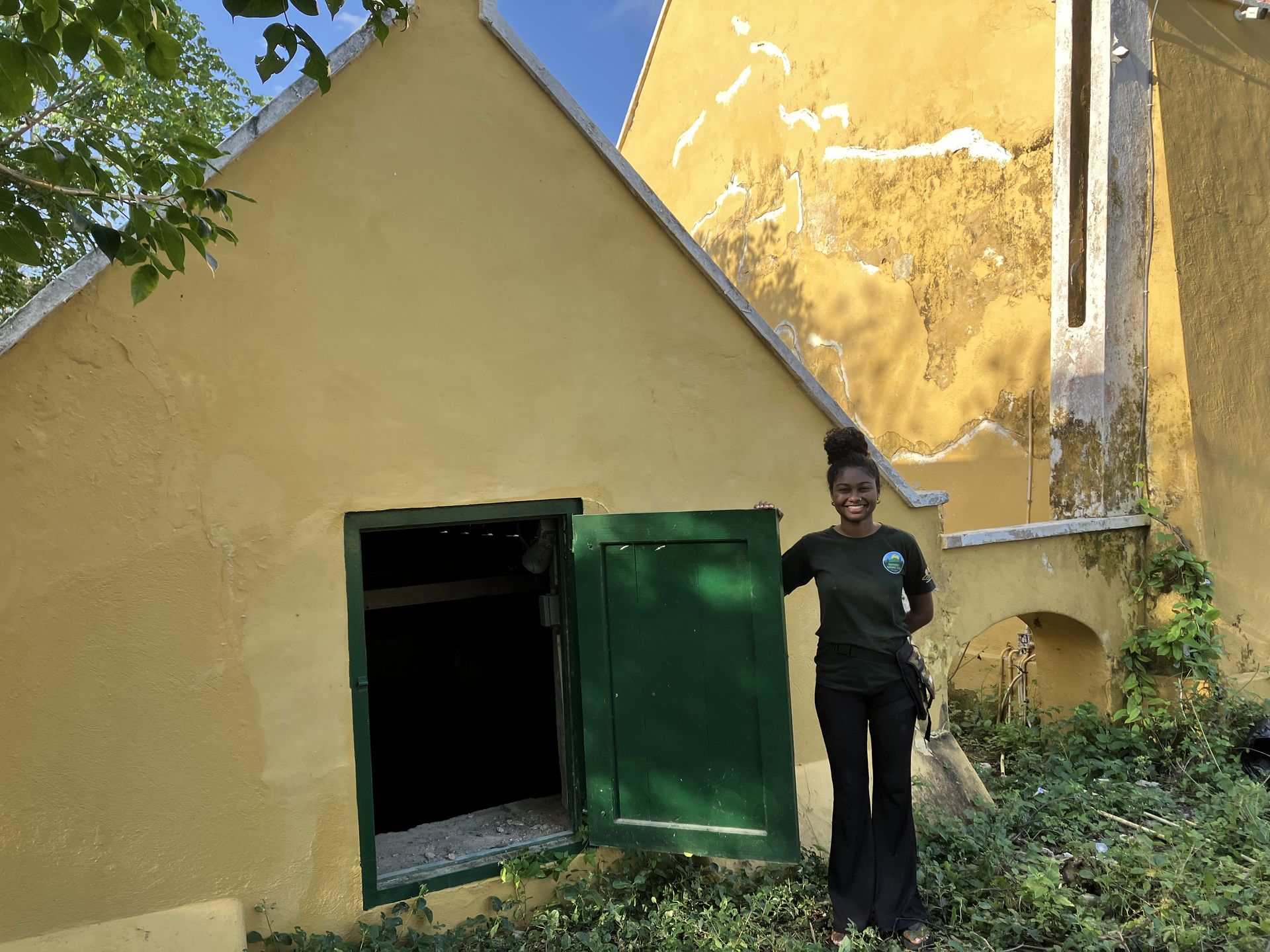
The cistern next to Savonet's magazina
The catchment area
Savonet is situated in a big catchment area. All the water from the north side of Christoffel Mountain and the northwest side of Table Mountain in Banda Bou (Sint Hieronymus) flows through Savonet to Boka Grandi on the north side of Christoffel Park. This catchment area is huge, and it drains a lot of water during and after a rain shower.
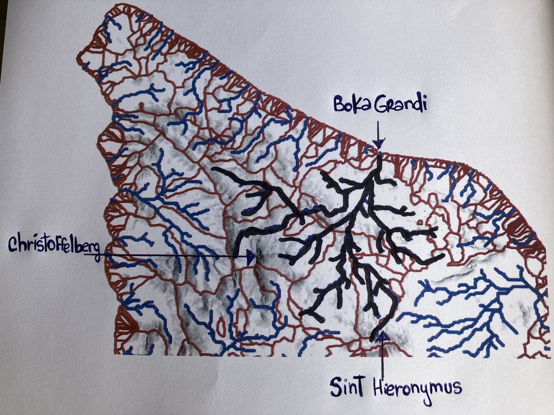
The catchment area in which Savonet is located
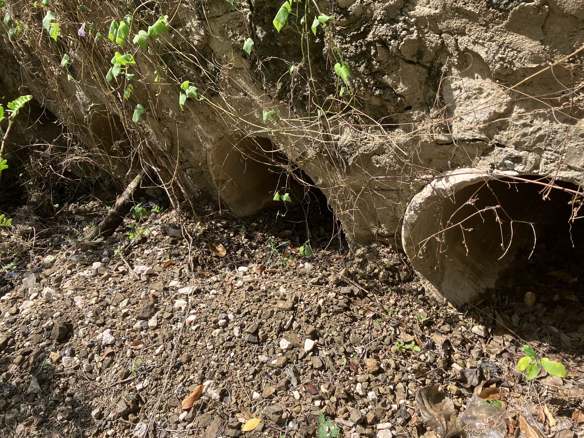
The rooien
The most important rooien of this rooien system have names. In the places where these rooien cross the Road to Westpunt, culverts have been built under the road in the present time. Culverts are underground pipes for the passage of water flows. Below, the most important rooien are discussed individually. Dams have been built in several places in these rooien. The information about the rooien comes from author and local expert of the Savonet area, Ergo (Echi) Cijntje.
Rooi Beru
The Rooi Beru crosses the Road to Westpunt, just east of the Savonet country house. The name Rooi Beru is a mix-up of “Beroerde Rooi”. Back in the day, this rooi was famous for flooding the Road to Westpunt during heavy rains. They didn’t have culverts back then, so it was a real mess. And guess what? It still happens sometimes in modern times when the culverts can’t handle the water rush.
Culverts Rooi Beru at Weg naar Westpunt
After the rooi passes the Road to Westpunt, it ends up at Dam Patia in the Christoffelpark. Dam Patia is a really long dam with two sakados. A sakado is like a spillway that lets extra water from the reservoir flow through to the next dam or the sea. Apparently, the dam was so long that two sakados were needed to handle all the extra water. From Dam Patia, the rooi continues to Boka Grandi on the north side. Dam Patia is currently being renovated as part of the Awa pa Korsou project. The photo below shows the work at one of the sakados of this dam.
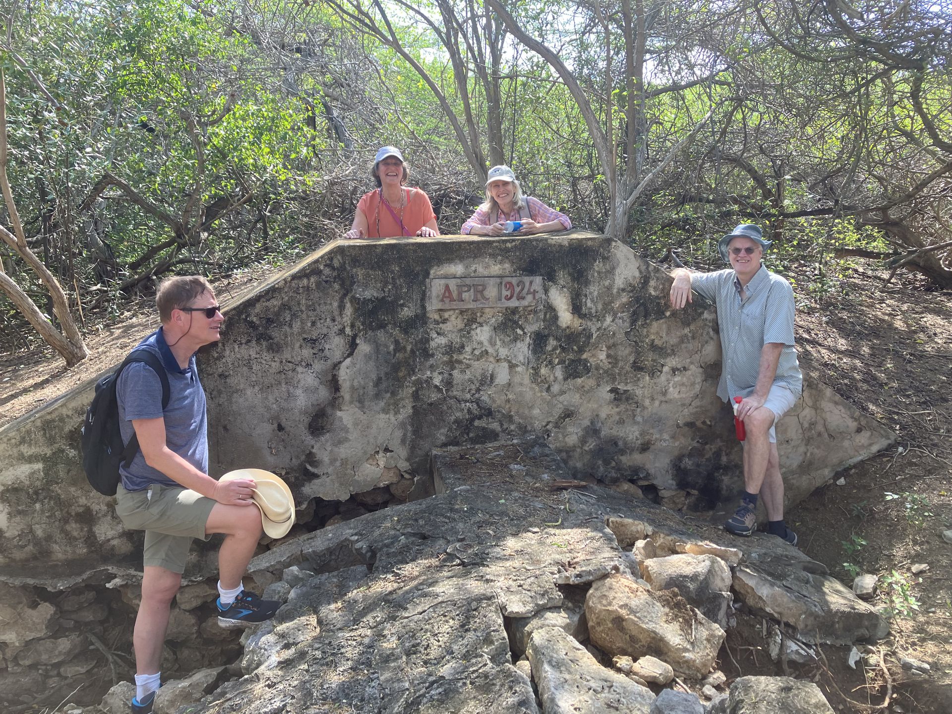
Renovation work at one of the sakado's of Dam Patia and also some visitors
Rooi di Baki
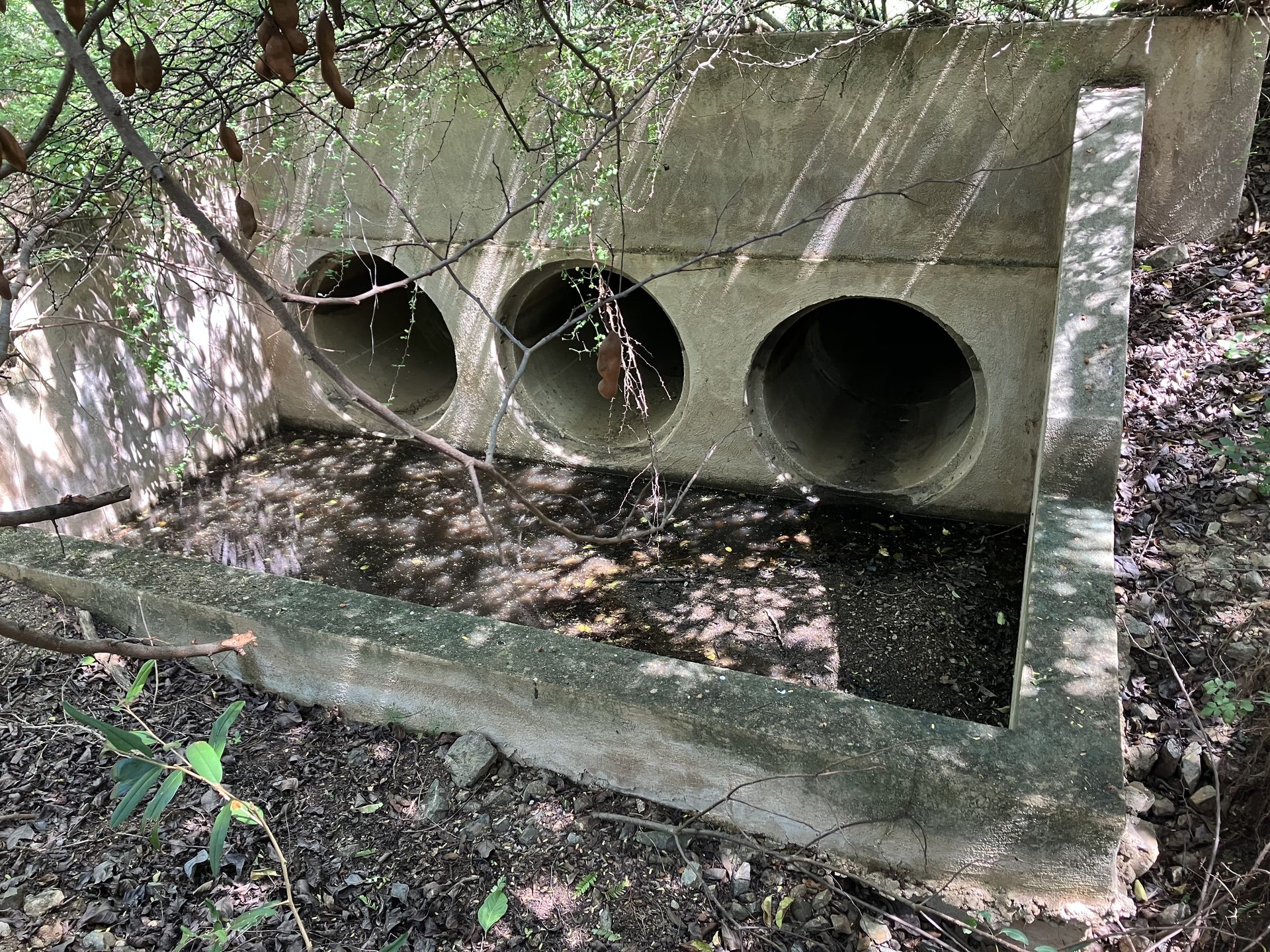
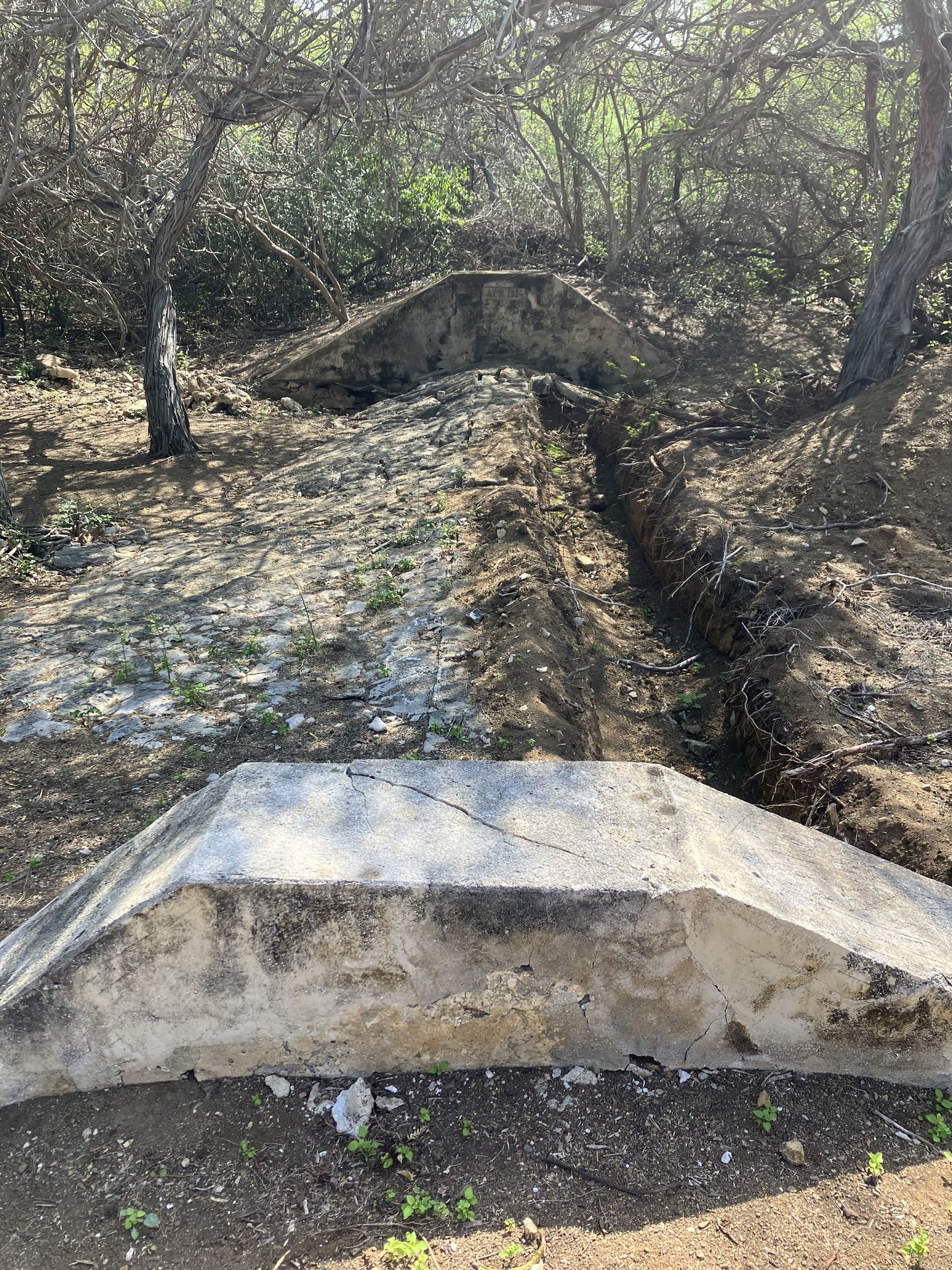
Rooi di Baki is a rooi that flows east of Rooi Beru. It’s named after the Dam di Baki in Pos Monton, in the Christoffel Park, where indigo tanks are also found. Both the dam and the rooi are named after these tanks. Rooi di Baki ends at Dam Transvaal, which you can see from the Road to West Point. In 1970, during heavy rains, Dam Transvaal partially collapsed. After Dam Transvaal, the rooi flows under the Road to Westpunt to Dam Patia. Culverts have been constructed to let the water pass under the road.
![]()
Transvaal dam and six culverts (only 3 visible) Rooi di Baki at Weg naar Westpunt
Rooi di Zòmé
This rooi runs via the Zòmé, a low-lying piece of land with many tall manzanilla trees, along the Road to Westpunt, also east of Savonet under the Road to Westpunt, towards the Patia dam.
Rooi San Antonie
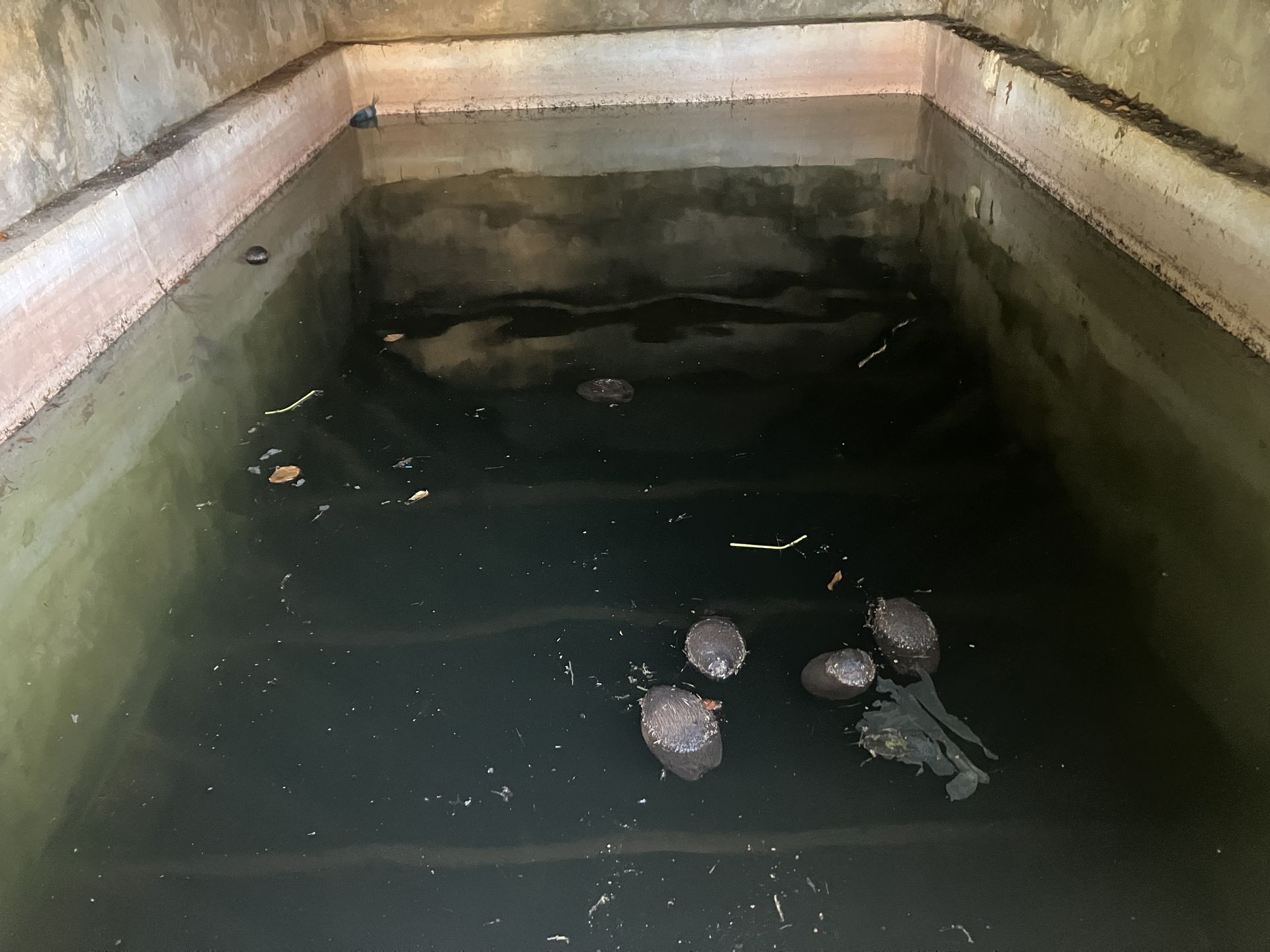
This rooi passes the Road to Westpunt west of Savonet. From Dam di Rooi San Antonie the rooi continues to Dam di Tugera, which is right behind the Savonet Country House. Behind the Tugera Dam are three wells: Pos di Tugera, Pos di Marikot, and Pos di Dualier. The water from these wells was used to grow veggies. The water from the Tugera Dam then flowed through the courtyard with fruit trees to Boka Grandi. You can also see a sakado here. Just behind this area is Pos Mulina. In the Tugera area, by the way, Carmabi (Naomi Cijntje) gives really interesting tours where you can learn how the dam and well system functioned.
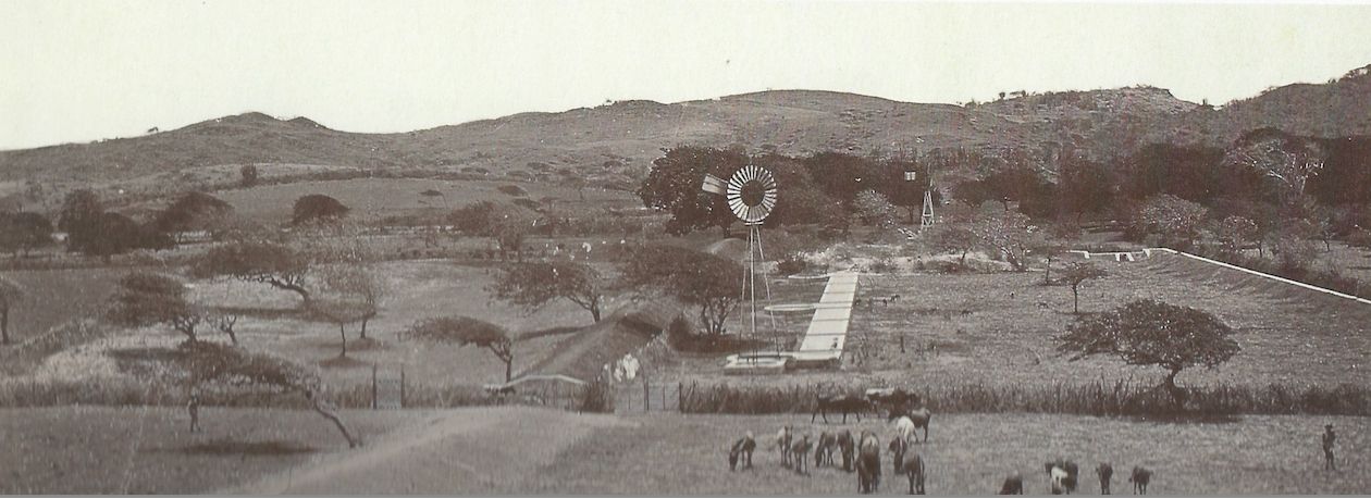
The Tugera with 3 wells and a windmill and to the left of this the Tugera dam and on the right the wall of Tugera (Muraya di Tugera) and in the background you can just see Pos Mulina (with windmill) (Foto credits Soublette)
The wells
Dams and wells are like best friends. Dams let water soak into the ground, and wells let us use it all year round. Savonet has lots of wells. There are Pos di Noori, Pos Seku, Pos Cuba, Pos di Lalu, Pos di Hoffi, Pos di Marikot, Pos di Dualier, Pos di Tugera, and Pos Mulina. And there are some walk-in wells or “Pos di Pia” too!
This section delves into the water management of the Savonet plantation. Thanks to its prime location with abundant rooien and a sophisticated network of dams and wells, this plantation was very productive. In the next part, we’ll explore the buildings of the plantation. Apart from the country house you find many additional buildings on a plantation.
4. Water Management on the Savonet Plantation